Data
Rasto · Pedrógão Grande 2017
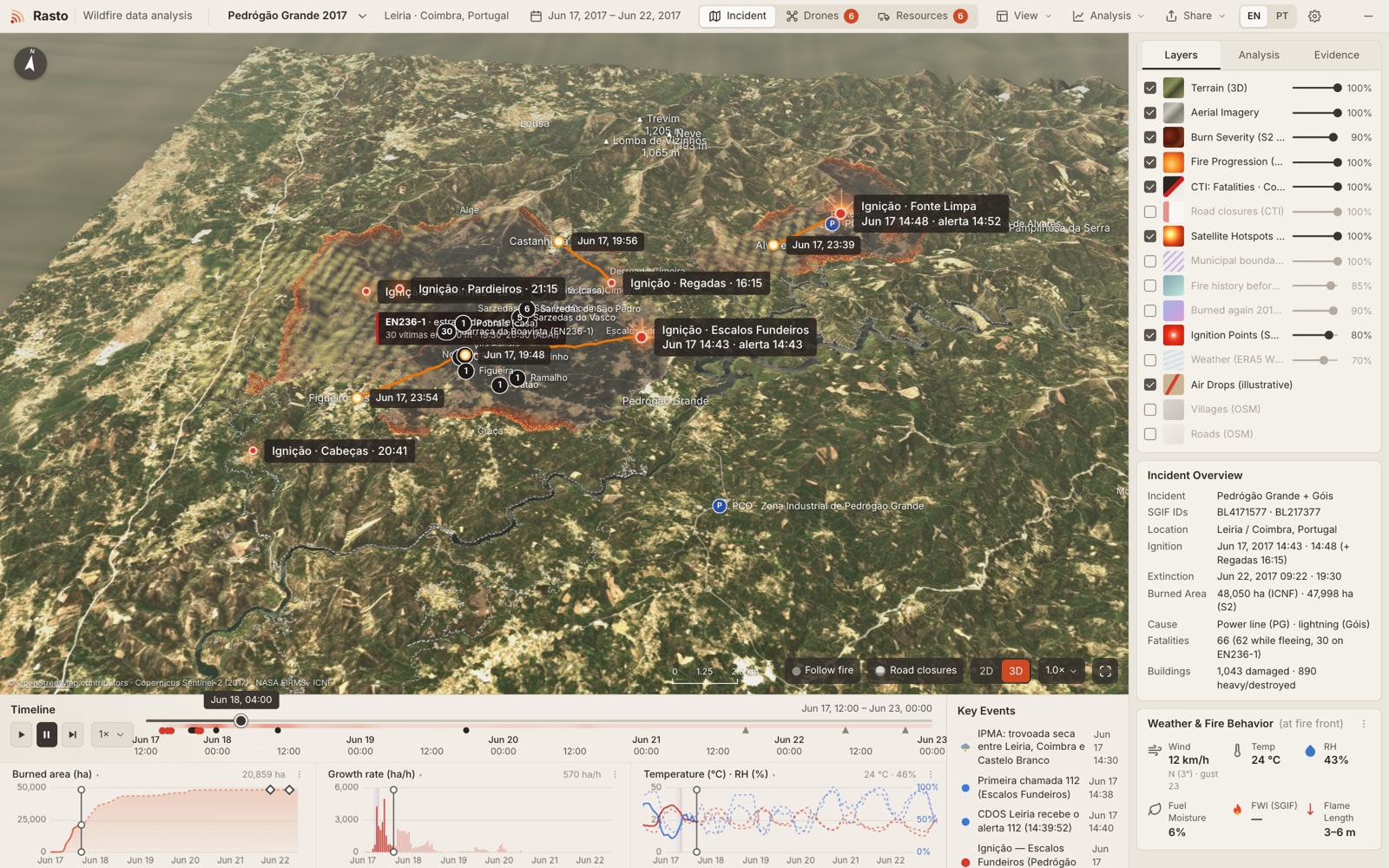
Interactive 3D reconstruction of the Pedrógão Grande and Góis wildfires (17–22 June 2017), built on real terrain, satellite and official data.
The grid below switches. Nothing is tucked under a long scroll.
Stack
PythonpandasrasterioSciPythree.jsSentinel-2
What’s in it
- •3D terrain with Sentinel-2 imagery
- •fire progression timeline
- •burn severity
- •analysis dashboard
- •fatalities vs fire arrival
- •resources and drone views
- •2D topo map
- •CSV and JSON export